So it's the start of the daily routine: wake up bleary eyed and a) Where am I? and b) check the SPC overnight forecast.
So it's a day of excitement and trepidation. The SPC has maintained the previous day's moderate risk but seam to be toying with a high risk for lunchtime's update. Here's a snippet: "outbreak of severe thunderstorms", "...long lived supercells...intense tornadoes...giant hail...destructive winds", but there are caveats in the forecast. And how about this set of parameters for central Oklahoma: MLCAPE 4000-5000 j/kg, dewpoints upper 60s to mid 70s Fahrenheit, 50-70 knot effective shear and storm relative helicity 400-700 j/kg. Wow, I've seen these parameters before but I can't remember seeing them all together when I've been over here before. "This is an uncommon (even for this time of year) environment supporting potentially dangerous supercells..."
I eventually roused Alex from his dreams of cowgirls and we headed off to breakfast, three items of sausage patties, fried potatoes and scrambled eggs. Washed down with some coffee (the Yorkshire tea bags are still unused as there was no hot water) it wasn't too bad TBH.
As we're already in the bullseye for today's storms it's a leisurely start. We'll meet at 10, get a reminder on the dos and don'ts then it's a case of picking a target and a lengthy wait before storms are expected to fire mid to late afternoon and into the evening.
One thing that has changed for the better since I first came in 2006 is the connectivity. Back then I could only get a cell signal in the OKC metro, now I can watch Rory playing cricket for Middlesbrough at Barnard Castle live. They lost.
Back to the routine: Starbucks and a coffee, I’m determined to stay away from the high calorie stuff…for now anyway.
Some discussion on the forecast with moisture location being a key variable. Potentially storms in the bullseye may be high based and outflow dominant, plus the prospect of chasing in the Oklahoma metro area is a none starter so we’re heading north for lunch at Enid and make an assessment when we get there, possibly looking at southern Kansas. A quick stop at Walmart and we’re going west on the I40, north on US74 then west on US15 to Enid.
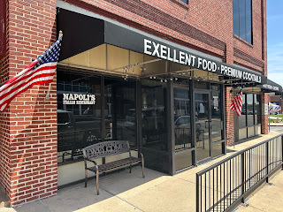
As we’ll be chasing late on we take the opportunity to get some food at Napoli’s Italian Restaurant (another salad) in Enid and we’re soon back on our way. It’s memorial weekend so there a flags everywhere. We head north on US81.
We head west and eventually reach Alva, Ok where we stop for a break. Chasers are beginning to congregate, you can pretty much guess where they’re from based on what type of ball they are playing with.
The SPC update remains at moderate with 15% hatched tornado risk and we’ve been under a Particularly Dangerous Situation for an hour or so. Storms have bubbled up in the Oklahoma Panhandle heading north east, we continue west on US64 to intercept At 16:40 one of the cells goes severe warned.
We keep going and stop for photos, do an about turn and head back east trying to get ahead of this thing which is travelling at a fair lick. More cells have gone severe warned. It’s now 18:00. 15 minutes later the cell to our south goes tornado warned.10 minutes after that we’re back at Alva where we take a left. We blast north through Kiowa into Kansas, and by 19:00 we have lightning, some sharp cloud to ground strikes, our storm taking on a flying eagle shape. We’re no that far from the hail core and there’s now a 68 knot rotation marker.
19:17 and the phone sound - tornado warning!!! We enter Anthony and the tornado sirens are going off. Another 40 minutes driving through torrential rain and the storm falls apart, the tornado warning being allowed to expire. A quick pit stop in Caldwell, a Big Mac in Wellington and we head off to the I35 towards Wichita and our hotel the Hawthorne Suites.
Total miles: 436


No comments:
Post a Comment